I write looking out at the Lammermuir Hills, waiting for the combine harvester to start work and watching the swallows darting about. As we get into the quieter summer holiday weeks, when there aren’t quite so many emails flying about, I am taking time to reflect on these first three months in post.
What has struck me most is the passion and care for their place and the land I have found in the local community. Complementing this is strong ambition and a high level of expertise, professionalism and knowledge. These qualities combine in a clear intention to work with the energy developers to leave East Lammermuir better as a result of the energy infrastructure. This vision is set out in the East Lammermuir Local Place Plan, giving a blueprint for what this could look like in practice.
Secondly, I have been impressed by the level of commitment to partnership working and engagement in the emerging Energy Projects Partnership from energy developers, transmission owners and East Lothian Council. The potential here for taking a place-based approach to sustainable development is huge and SO exciting!
So what is an Energy Projects Partnership? Why is it needed and who is involved? Who funds the work? I have put together a “frequently asked questions” webpage which can answer some of these. Check it out and let me know if you have any other FAQs on beth@elep.scot
One of the main focuses of my work so far has been to improve communications and access to information, a vital component of partnership working. Two key tools I have been working on are:
- An email news bulletin – this is primarily intended for the local community to keep up to date on all related topics, from planning applications and construction impacts to community benefits.
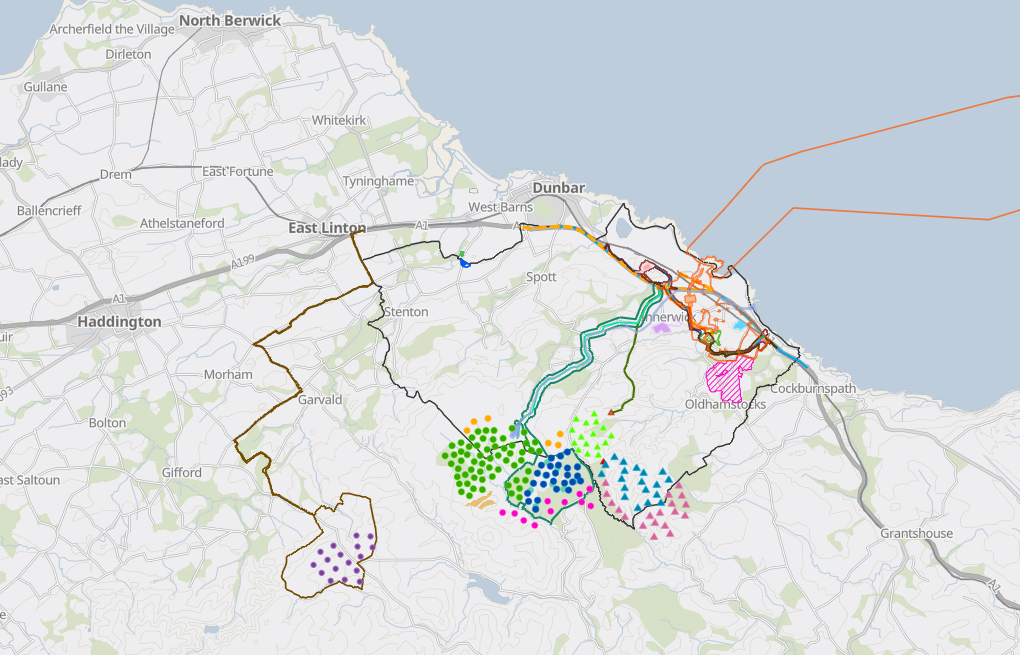
- The Energy Developments map – Featured in the image above. I am working with SSE Renewables (who kindly built the map) to keep it updated and to add in extra map layers for biodiversity sites and access paths.
I love maps! Maps enable us to visualise what is planned by multiple partners and how that might work together on the ground. Land use is where the interplay of this partnership becomes real.
Opportunities to contribute toward community priorities for active travel and restoring biodiversity in the area can be explored through examining maps of existing and proposed energy developments overlayed with maps of potential access routes and biodiversity corridors.
So much ground work has already been done in East Lammermuir through mapping out community priorities in the Local Place Plan.
Maps really are a powerful tool! I’m so excited to see how they can be used as part of a toolkit to help achieve the community’s ambition of the area being left better as a result of the energy developments.
Enjoy your summer!